Showing posts with label South Unit. Show all posts
Friday, August 24, 2012
Monday, June 4, 2012
Dead, Dung and Dirt: Theodore Roosevelt National Park
Heading out after a big storm to the TRNP we found ourselves a perfect day, light breeze, blue sky's and high 70's gave us the perfect setting for a short hike on the central section of the roundup trail.
We started along the norther park of the parks driving loop and headed towards the north boarder of the park along the roundup trail. The map said that it was about 1.2 miles till the trail crossed the roundup group campsite access road, where we thought would be a good place to turn back.
Our first exciting find, a dead deer.
Second was a dung beetle. Third was an incredible amount of dirt in all types and moisture levels(however unable to capture a picture of the diversity)
Spring Flowers have started and we found several cactus with these lovely yellow flowers.
Returning back to our car we took one last look at the very mini forest that the trail had taken us through!
Next stop a 0.8 viewing trail, Biocurt Overlook. The first 0.2 miles is accessible with a wide flat gravel trail complete with overlooks!
towards the end of the trail one heads up on a ridge
allowing a stretching view of these rolling plains amid the badlands. We encountered a park ranger out here who informed us that this is frequently a great place to spot herds of wild horses.
Trail: Roundup central section- A few challenging areas mostly due to mud, overall an easy hike.
Parking: You must pull off the road, no clear parking area to access it at the norther loop crossover. Marked, but you must be on the look out it would be easy to miss
Miles: 1.2 one way
Wildlife: Dung Beetle
Trail: Boicourt overlook - first section is accessible for all, the second section is an easy walk, however is fairly narrow, might not be the best for smaller children.
Parking: Clearly marked parking area just off of the loop
Miles: under 0.8 one way
Wildlife: none this time
Thursday, May 24, 2012
South Unit Visitor Center & Upper Talkington Trail
We had one of those perfect day early may and headed off to the Theodore Roosevelt National Park, South Unit. Meeting a friend at the park we explored the visitor center while we waited.
The log cabin is open with the rooms decorated in the time era, giving you a chance to step back in time, with the exception of the divider glass and the few pieces that are clearly more recent =)
| Visitor Center Education Space |
| Old Beef Processing Factory |
| Baby Bison |
| Wild Horses |
| Horseback Riders |
Monday, May 7, 2012
Another TRNP Post
I rarely find others who have posted on the Theodore Roosevelt National Park, but did come across this park summary from a 2007 road trip blog: http://www.davidjohnsen.com/travels/2007pnw/day3.html
I slept better and we got an earlier start than on Thursday. After another Country Kitchen breakfast, we drove west to Medora, home of the South Unit of Theodore Roosevelt National Park. I made my first bad music choice of the vacation, Disc One from Guilty: 30 years of Randy Newman. Newman is an acquired taste, and my wife hadn't heard more than a song or two. Plus it's too quiet and nuanced to be good road music......
Location:
Dickinson, ND 58601, USA
Monday, February 27, 2012
Upper Paddock Creek trail
Mid January and we were missing the park, we headed to the Upper Paddock Creek Trail. There is a nice parking spot just past a drainage bridge, large enough to get just one car off the road.
Just a stark and brisk day to be in the park, but what else could you expect from an early January day. With surprisingly little snow we headed out to get a few miles under our feet and see how the landscape has been doing this winter. I having done the part of this trail during the late summer was excited to see what the differences would be with the passing of the seasons.
We started at the trail head off of the Scenic Loop Drive and slowly descended into the valley. Passing across fields we encountered the most interesting pit of mostly dry mud, trekked over an array of animal prints and poop, leaped across a mucky creek bed, contemplated taking the old trail that had eroded into a steep bluff and found ourselves flanked by painted canyons and standing on grassy table tops with dried and not so dry creek beds below us. A mile and a half in we were in an unrecognizable different world than where we had parked out truck. We took a few moment to take in the beauty and enjoy the weather before turning around and heading back to civilization.
No wildlife today, a trail that is accommodating to those who do not hike much but may pose challenges to very small children.
Just a stark and brisk day to be in the park, but what else could you expect from an early January day. With surprisingly little snow we headed out to get a few miles under our feet and see how the landscape has been doing this winter. I having done the part of this trail during the late summer was excited to see what the differences would be with the passing of the seasons.
We started at the trail head off of the Scenic Loop Drive and slowly descended into the valley. Passing across fields we encountered the most interesting pit of mostly dry mud, trekked over an array of animal prints and poop, leaped across a mucky creek bed, contemplated taking the old trail that had eroded into a steep bluff and found ourselves flanked by painted canyons and standing on grassy table tops with dried and not so dry creek beds below us. A mile and a half in we were in an unrecognizable different world than where we had parked out truck. We took a few moment to take in the beauty and enjoy the weather before turning around and heading back to civilization.
No wildlife today, a trail that is accommodating to those who do not hike much but may pose challenges to very small children.
Coal Vein Trail
Ian has just moved to Dickinson and I was determined to show him the very best we had to offer. Being a bit tiered after his journey here we opted to drive the loop in the park and walk the 1.2 mile coal vein trail.
Overly enthusiastic we parked our truck and took off on the first trail head we saw, less than 1/4 mile in we came across a large deer family. We both slowed down and spent a moment taking in the beauty and power of these wild animals, each taking our turn to talk to them!
As we progressed along we noticed several marking posts and begun to wonder if we had missed something along the way. The trail is windy has small bridges and heads up and down small valleys. As we dashed along we paused here and there to read tree and plan markers, familiarizing ourselves with our new home. Neither of us sure what a burnt out coal vein should look like we pause on outlooks and made our best educated guesses.
The trail ends much as it begins in a field, however upon reached the end we realized that we had completely skipped the self guided informational pamphlet as well as the history placard for the area, both of which I would recommend for those who are on this trail.
This is a fairly easy trail and most doable for those with young children or those who do not hike very often.
Overly enthusiastic we parked our truck and took off on the first trail head we saw, less than 1/4 mile in we came across a large deer family. We both slowed down and spent a moment taking in the beauty and power of these wild animals, each taking our turn to talk to them!
As we progressed along we noticed several marking posts and begun to wonder if we had missed something along the way. The trail is windy has small bridges and heads up and down small valleys. As we dashed along we paused here and there to read tree and plan markers, familiarizing ourselves with our new home. Neither of us sure what a burnt out coal vein should look like we pause on outlooks and made our best educated guesses.
The trail ends much as it begins in a field, however upon reached the end we realized that we had completely skipped the self guided informational pamphlet as well as the history placard for the area, both of which I would recommend for those who are on this trail.
This is a fairly easy trail and most doable for those with young children or those who do not hike very often.
3 Short hikes in the South Unit, Theodore Roosevelt National park
With my Brothers visit our family headed out to the park once again. Wanting to take in as much as possible in the limited time frame, we selected several short activities to give us a full sample.
Starting at the western visitor center we did a dramatic drop into the canyon and back out all in under 1 mile. This is the most traversed path I have seen in the park and would present quite a challenge to young children or those who have not spent time hiking.
Leaving the eastern edge we passed through a very sleepy Medora into the main park. We drove the South Unit loop heading on the eastern side till we reached the Jones Creek Trail.
The Jones Creek trail runs through the middle of the south unit, and if you have a driver you can hike across the center of the loop, a nice 3.7 miles, mostly flat, a few small creek crossings, gorgeous outcroppings and mostly flanked by the Jones Creek.
Getting picked up on the east end of the trail we continued on the loop till we reached the ridge-line trail. A short 0.6 miles can be self guided with a brochure found at the trail head. It starts out on a very steep incline to put you on top of the world, giving you fantastic views of the park (by far the best I have seen so far). A short while after reaching the top the trail loops and the tour brings you down one side of the ridge where you pass along a burn area and can see the regrowth following the destruction, steep steps back up the side of the ridge you connect with the original trail, having a second opportunity to take in the vast complexities of the park you head back down to the road.
Our family finished the loop and headed to the visitor center at the main entrance to the south unite. Inside we watched the movie on TR's history with the park and explored the visitor center.
A great day, saw Bison, Deer, Prairie Dogs and several Hawks
Sunday, October 9, 2011
Petrified Forest West Access Trail
Starting Point : Petrified Forest West Boundary Access
Exit towards W river road. This is two exits west of the main Medora / Park exit. At the stop sign at the end of the exit ramp you will take a right. It is about 7miles up this road. The road itself curves and branches quite a bit, when i went there were signs directing you the whole way. The road can be quite challenging in the spring when there has been a lot of wash out or if they have recently re-graveled. There are many oil wells along the road so the trucks have done a good job of packing it down
You will find a small parking lot just before the gate to access the trail. The trail starts off flat and than climbs for about 1/2 a mile till you reach a junction. We went to the left and after a a mile including an 1/8 mile drop we found ourselves in the forest. If you stay on the trail it will wind you directly through some amazing petrified trees. It is a large area and I found that wandering a bit off trail got me in groves that I would have missed staying on the path
The brown markers for this trail are about 6 inches across and 4 feet high. They are fairly easy to find. It looks as if they are in the process of putting in wooden post markers. In some places the wooden markers and the brown markers were up.
We hiked up out of the forest grove onto the grasslands and followed them for another 1/2 mile and turned back to our car. The grasslands kept going, my guess is for another 1.5 miles at least.
I saw some great butterfly's and birds and lots of crickets. We saw signs of larger mammals but did not encounter any. 6 other people were on the trail that Sunday, but we never felt crowded.
We hiked up out of the forest grove onto the grasslands and followed them for another 1/2 mile and turned back to our car. The grasslands kept going, my guess is for another 1.5 miles at least.
| Petrified Forest from the east |
I saw some great butterfly's and birds and lots of crickets. We saw signs of larger mammals but did not encounter any. 6 other people were on the trail that Sunday, but we never felt crowded.
Sunday, September 25, 2011
Painted Canyon Visitor Center Access Trail & Western Upper Paddock Creek Trail
Starting Point : Painted Canyon Visitor Center
Exit towards Painted Canyon Visitor Center. You will see large signs and find yourself in an establish parking lot.
The center is a great place to start a hike, they have bathrooms, water fountains, snack machines and if you arrive during business hours the visitor center has an array of things. I stopped by the visitor center my first time in the park to get maps, hike advice and a local wildlife and plan update. The staff was very helpful and the maps they have are better than the ones I found on line.
| Upper Paddock Creek Trail |
Wildlife and Plants in the Theodore Roosevelt National Park South Unit: Bison are a relatively calm animal however it is advised that you give them their space, they are large and can be dangerous. The park is home to rattlesnakes, don't go sticking your bare hand into tall grass patches that's when they have the highest rate of bites. Beyond those two, things are fairly standard.
The access trail starts to the south west of the visitor center. Standing in the parking lot you will see an access road going off the western side, follow this road about 1/5 mile till you see a brown marker on your left side. Near the brown marker you will notice a foot path veer away from the road, this is the trail head.
The brown markers for this trail are about 6 inches across and 4 feet high. They are fairly easy to find.
The trail almost instantly heads into the canyon. Footing can be questionable during the decent due to the soft nature of the soil. There are several areas where the trail has caved in, as the canyon slowly grows. Keep an eye on your footwork and you will be fine.
There are a few places where small creeks cross the trail, I have gone in fairly wet times and been able to easily jump these creeks.
At the base of the Access Trail you come to a sign that point north/ west and south/ east. Both directions will put you on the Upper Paddock Creek Trail.
On this day I went north/west. I was interested in doing a 6 mile hike this day, 2 miles to get into the canyon and went about 1.5 miles west on Upper Paddock Creek Trail.
I saw some great butterfly's and birds. I sat at a nice outcropping and read a book for about an hour and than returned back the way I came. This hike was very isolated, I did not see any people or mammals from start to finish.
The access trail starts to the south west of the visitor center. Standing in the parking lot you will see an access road going off the western side, follow this road about 1/5 mile till you see a brown marker on your left side. Near the brown marker you will notice a foot path veer away from the road, this is the trail head.
The brown markers for this trail are about 6 inches across and 4 feet high. They are fairly easy to find.
The trail almost instantly heads into the canyon. Footing can be questionable during the decent due to the soft nature of the soil. There are several areas where the trail has caved in, as the canyon slowly grows. Keep an eye on your footwork and you will be fine.
There are a few places where small creeks cross the trail, I have gone in fairly wet times and been able to easily jump these creeks.
At the base of the Access Trail you come to a sign that point north/ west and south/ east. Both directions will put you on the Upper Paddock Creek Trail.
On this day I went north/west. I was interested in doing a 6 mile hike this day, 2 miles to get into the canyon and went about 1.5 miles west on Upper Paddock Creek Trail.
I saw some great butterfly's and birds. I sat at a nice outcropping and read a book for about an hour and than returned back the way I came. This hike was very isolated, I did not see any people or mammals from start to finish.
Saturday, September 24, 2011
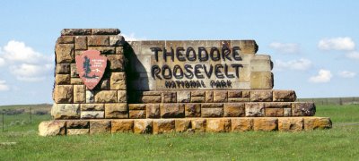
Theodore Roosevelt National Park
Since moving to Dickinson ND I have been spending almost every weekend hiking in the Theodore Roosevelt National Park. I have an array of comments on this experience.
- The park is divided into two separated areas the North Unit and the South Unit.
- The South Unit in along side interstate 94
- The eastern corner of this park is about a 20min drive from Dickinson.
- You can access the park on foot from a variety of entrance points
- To access the park by car you must enter at the Medora Visitor center and pay a $10 fee for a 6 day park access
Subscribe to:
Posts (Atom)